
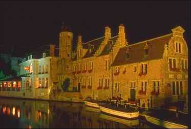
Bruges (Brugge) was founded in the 9th century by Vikings who settled here at the end of the little river 'de Reie'. The name Bruges is probably derived from the old-Scandinavian word 'Brygga', which means 'harbor, or mooring place'. Because of the proximity of the North Sea, the settlement very quickly became an important international harbor. A sea-arm, called the Zwin, connected Bruges with the North Sea. The young settlement acquired city rights as early as the 12th century. At that time a first protective wall was built around Bruges. Soon, however, the Zwin started to silt up. This would have caused major problems for the city, were it not that Bruges adapted itself to this situation by creating outports in Damme and in Sluis. Moreover, transport of goods over land became more and more usual. In the 14th century Bruges became the starting point of a commercial transport road to the Rhineland (over Brussels and Leuven, cities in Brabant which also started to flourish because of this trade).

The Bruges bear in the Porters Lodge.Already in the 13th century Bruges was an important international trading center. Traders from all over the then known world came to the city to sell their products to each other and to buy Flemish cloth, a internationally acclaimed textile product, produced in different Flemish cities (e.g. Gent). In the early 14th century Bruges was the scene of political unrest between the citizens and the count of Flanders. Because of this unrest the French king tried to annex the county of Flanders, but the population managed to kick out the French garisson on May the 18th 1302. Later the Flemish army beat the French army in the 'Battle of the Golden Spurs' on July the 11th in the Flemish city of Kortrijk.

In the 14th century Bruges turned also into an international financial and trading center. It became the wharehouse of the North-European Hanza cities. Several countries had their own representation in Bruges: the Italians, the Germans, the Scottish, the Spanish made the city into a true European center where different languages could be heard and where the most exotic products could be found.
The decline of Bruges' wealth started in the 15th century : the unstoppable silting up of the Zwin, the competition with the bigger harbor of Antwerp and the crisis in the cloth industry resulted in less commercial activity. The crisis, however, was not immediately noticable. Bruges continued to construct splendid late-gothic buildings and churches, and the Flemish painting school (with e.g. the brothers Van Eyck and Hans Memling ) started to flourish as never before.

By the end of the 16th century the former glory was only a memory and Bruges slipped into a wintersleep that took several centuries. New textile industries were introduced in the 19th century, but to no avail. In the middle of the 1800's Brugge was the poorest city in Belgium. The 20th century, however, brought new life. The city was discovered by the international tourism and the medieval heritage turned out to be a new source of wealth for the 'Venice of the North'. Economically and industrially another important evolution took place. The new harbor of Zeebrugge (Seabruges-at 10 miles outside of the city, at the Belgian coast) brought new developments and new industries to the region.
article source : http://www.trabel.com/brugge/bruges-history.htm


 enjoy the beauty of brugges in belgium pictures


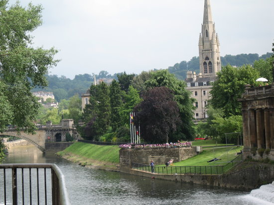 The City of Bath England. A World Heritage City, visited by thousands of people from all over the world. On this site you will find a comprehensive listing with information on almost every aspect of visiting and living in Bath. Experience the richness and diversity that our City has to offer, from your-virtual window on the world.


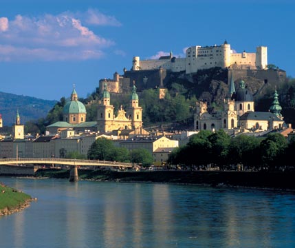


 Traces of human settlements have been found in the area, dating to the Neolithic Age. The first settlements at Salzburg were apparently begun by the Celts. Around 15 BC the separate settlements were merged into one city by the Romans. At this time the city was called Juvavum and was awarded the status of a Roman municipium in 45 AD. Juvavum developed into an important town of the Roman province of Noricum. Juvavum declined sharply after the collapse of the Norican frontier, such that by the late 7th century it had become a "near ruin".


 this pictures is a Banff National park in canada. every one can refreshing in this place be happy
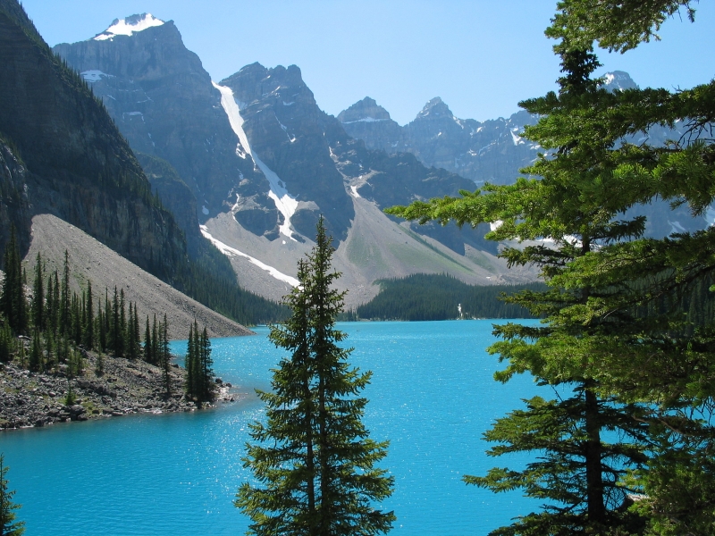


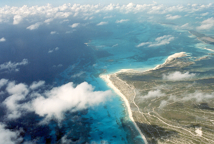

 So if you have chane to visit Cuba or Cayo Largo do it as soon as you can as Cayo Largo is real paradise on earth and after first visit you will wish to come many more times to Cayo Largo.


