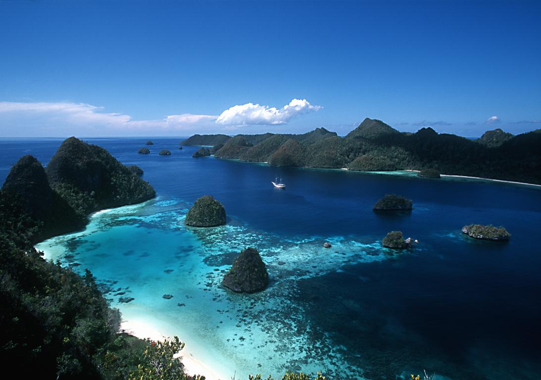
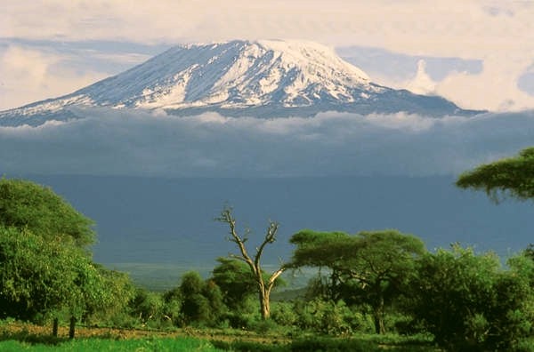
Komodo National Park lies in the Wallacea Region of Indonesia, identified by WWF and Conservation International as a global conservation priority area. The Park is located between the islands of Sumbawa and Flores at the border of the Nusa Tenggara Timur (NTT) and Nusa Tenggara Barat (NTP) provinces. It includes three major islands, Komodo, Rinca and Padar, and numerous smaller islands together totaling 603 km2 of land. The total size of Komodo National Park is presently 1,817 km2. Proposed extensions of 25 km2 of land (Banta Island) and 479 km2 of marine waters would bring the total surface area up to 2,321 km2.
History :
Komodo National Park was established in 1980 and was declared a World Heritage Site and a Man and Biosphere Reserve by UNESCO in 1986. The park was initially established to conserve the unique Komodo dragon (Varanus komodoensis), first discovered by the scientific world in 1911 by J.K.H. Van Steyn. Since then conservation goals have expanded to protecting its entire biodiversity, both marine and terrestrial.
The majority of the people in and around the Park are fishermen originally from Bima (Sumbawa), Manggarai, South Flores, and South Sulawesi. Those from South Sulawesi are from the Suku Bajau or Bugis ethnic groups. The Suku Bajau were originally nomadic and moved from location to location in the region of Sulawesi, Nusa Tenggara and Maluku, to make their livelihoods. Descendents of the original people of Komodo, the Ata Modo, still live in Komodo, but there are no pure blood people left and their culture and language is slowly being integrated with the recent migrants.
Little is known of the early history of the Komodo islanders. They were subjects of the Sultanate of Bima, although the island’s remoteness from Bima meant its affairs were probably little troubled by the Sultanate other than by occasional demand for tribute.
DEMOGRAPHICS :
There are presently almost 4,000 inhabitants living within the park spread out over four settlements (Komodo, Rinca, Kerora, and Papagaran). All villages existed prior to 1980 before the area was declared a national park. In 1928 there were only 30 people living in Komodo Village, and approximately 250 people on Rinca Island in 1930. The population increased rapidly, and by 1999, there were 281 families numbering 1,169 people on Komodo, meaning that the local population had increased exponentially.
Komodo Village has had the highest population increase of the villages within the Park, mostly due to migration by people from Sape, Manggarai, Madura, and South Sulawesi. The number of buildings in Kampung Komodo has increased rapidly from 30 houses in 1958, to 194 houses in 1994, and 270 houses in 2000. Papagaran village is similar in size, with 258 families totaling 1,078 people. As of 1999, Rinca’s population was 835, and Kerora's population was 185 people. The total population currently living in the Park is 3,267 people, while 16,816 people live in the area immediately surrounding the Park.
EDUCATION :
The average level of education in the villages of Komodo National Park is grade four of elementary school. There is an elementary school located in each of the villages, but new students are not recruited each year. On average, each village has four classes and four teachers. Most of the children from the small islands in the Kecamatan Komodo (Komodo, Rinca, Kerora, Papagaran, Mesa) do not finish elementary school. Less than 10% of those which do graduate from elementary school will continue to high school since the major economic opportunity (fishing) does not require further education. Children must be sent to Labuan Bajo to attend high school, but this is rarely done in fishermen’s families.
HEALTH :
Most of the villages located in and around the Park have few fresh water facilities available, if any, particularly during the dry season. Water quality declines during this time period and many people become ill. Malaria and diarrhea are rampant in the area. On Mesa island, with a population of around 1,500 people, there is no fresh water available. Fresh water is brought by boat in jerrycans from Labuan Bajo. Each family needs an average of Rp 100,000.- per month to buy fresh water (2000). Almost every village has a local medical facility with staff, and at least a paramedic. The quality of medical care facilities is low.
SOCIO-CULTURAL AND ANTHROPOLOGIC CONDITIONS :
Traditional Customs: Traditional communities in Komodo, Flores and Sumbawa have been subjected to outside influences and the influence of traditional customs is dwindling. Television, radio, and increased mobility have all played a part in accelerating the rate of change. There has been a steady influx of migrants into the area. At the moment nearly all villages consist of more than one ethnic group.
Religion: The majority of fishermen living in the villages in the vicinity of the Park are Muslims. Hajis have a strong influence in the dynamics of community development. Fishermen hailing from South Sulawesi (Bajau, Bugis) and Bima are mostly Moslems. The community from Manggarai are mostly Christians.
Anthropology and Language: There are several cultural sites within the Park, particularly on Komodo Island. These sites are not well documented, however, and there are many questions concerning the history of human inhabitance on the island. Outside the Park, in Warloka village on Flores, there is a Chinese trading post remnant of some interest. Archeological finds from this site have been looted in the recent past. Most communities in and around the Park can speak Bahasa Indonesia. Bajo language is the language used for daily communication in most communities.
TERRESTRIAL PHYSICAL ENVIRONMENT :
Topography: The topography is varied, with slopes from 0 – 80%. There is little flat ground, and that is generally located near the beach. The altitude varies from sea level to 735 m above sea level. The highest peak is Gunung Satalibo on Komodo Island.
Geology: The islands in Komodo National Park are volcanic in origin. The area is at the juncture of two continental plates: Sahul and Sunda. The friction of these two plates has led to large volcanic eruptions and caused the up-thrusting of coral reefs. Although there are no active volcanoes in the park, tremors from Gili Banta (last eruption 1957) and Gunung Sangeang Api (last eruption 1996) are common. West Komodo probably formed during the Jurasic era approximately 130 million years ago. East Komodo, Rinca, and Padar probably formed approximately 49 million years ago during the Eocene era.
Climate: Komodo National Park has little or no rainfall for approximately 8 months of the year, and is strongly impacted by monsoonal rains. High humidity levels year round are only found in the quasi-cloud forests on mountain tops and ridges. Temperatures generally range from 170C to 340C, with an average humidity level of 36%. From November through March the wind is from the west and causes large waves that hit the entire length of Komodo island’s west beach. From April through October the wind is dry and large waves hit the south beaches of Rinca and Komodo islands.
TERRESTRIAL ECOSYSTEMS :
The terrestrial ecosystems are strongly affected by the climate: a lengthy dry season with high temperatures and low rainfall, and seasonal monsoon rains. The Park is situated in a transition zone between Australian and Asian flora and fauna. Terrestrial ecosystems include open grass-woodland savanna, tropical deciduous (monsoon) forest, and quasi cloud forest.
Due to the dry climate, terrestrial plant species richness is relatively low. The majority of terrestrial species are xerophytic and have specific adaptations to help them obtain and retain water. Past fires have selected for species that are fire-adapted, such as some grass species and shrubs. Terrestrial plants found in Komodo National Park include grasses, shrubs, orchids, and trees. Important food tree species for the local fauna include Jatropha curkas, Zizyphus sp., Opuntia sp., Tamarindus indicus, Borassus flabellifer, Sterculia foetida, Ficus sp., Cicus sp., ‘Kedongdong hutan’ (Garuga floribunda), and ‘Kesambi’ (Schleichera oleosa).
TERRESTRIAL FAUNA :
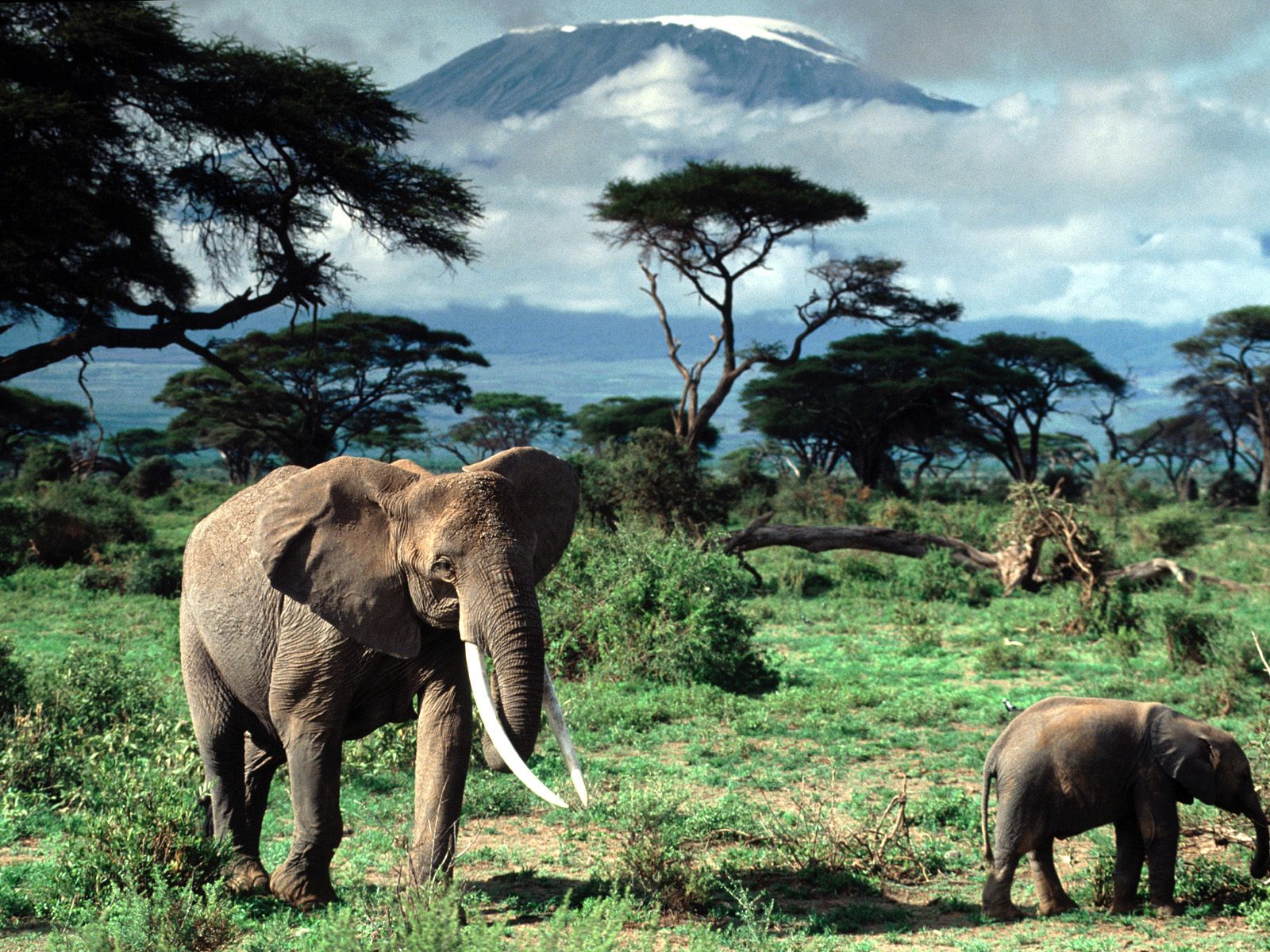
The terrestrial fauna is of rather poor diversity in comparison to the marine fauna. The number of terrestrial animal species found in the Park is not high, but the area is important from a conservation perspective as some species are endemic. Many of the mammals are Asiatic in origin (e.g., deer, pig, macaques, civet). Several of the reptiles and birds are Australian in origin. These include the orange-footed scrubfowl, the lesser sulpher-crested cockatoo and the nosy friarbird.
Reptiles: The most famous of Komodo National Park's reptiles is the Komodo Dragon (Varanus komodoensis). It is among the world's largest reptiles and can reach 3 meters or more in length and weigh over 70kg.
Other than the Komodo Dragon twelve terrestrial snake species are found on the island. including the cobra (Naja naja sputatrix), Russel’s pit viper (Vipera russeli), and the green tree vipers (Trimeresurus albolabris). Lizards include 9 skink species (Scinidae), geckos (Gekkonidae), limbless lizards (Dibamidae), and, of course, the monitor lizards (Varanidae). Frogs include the Asian Bullfrog (Kaloula baleata), Oreophyne jeffersoniana and Oreophyne darewskyi. They are typically found at higher, moister altitudes.
Mammals: Mammals include the Timor deer (Cervus timorensis), the main prey of the Komodo dragon, horses (Equus sp.), water buffalo (Bubalus bubalis), wild boar (Sus scrofa vittatus), long-tailed macaques (Macaca fascicularis), palm civets (Paradoxurus hermaphroditus lehmanni), the endemic Rinca rat (Rattus rintjanus), and fruit bats. One can also find goats, dogs and domestic cats.
Birds: One of the main bird species is the orange-footed scrub fowl (Megapodius reinwardti), a ground dwelling bird. In areas of savanna, 27 species were observed. Geopelia striata and Streptopelia chinensis were the most common species. In mixed deciduous habitat, 28 bird species were observed, and Philemon buceroides, Ducula aenea, and Zosterops chloris were the most common.
MARINE PHYSICAL ENVIRONMENT :
The marine area constitutes 67% of the Park. The open waters in the Park are between 100 and 200 m deep. The straits between Rinca and Flores and between Padar and Rinca, are relatively shallow (30 to 70 m deep), with strong tidal currents. The combination of strong currents, coral reefs and islets make navigation around the islands in Komodo National Park difficult and dangerous. Sheltered deep anchorage is available at the bay of Loh Liang on Komodo’s east coast, the South East coast of Padar, and the bays of Loh Kima and Loh Dasami on Rinca. In the North of the Park water temperature ranges between 25 – 29°C. In the middle, the temperature ranges between 24 and 28°C. The temperatures are lowest in the South, ranging from 22 – 28°C. Water salinity is about 34 ppt and the water is quite clear, although the waters closer to the islands are relatively more turbid.
MARINE ECOSYSTEMS :
Indonesia is the only equatorial region in the world where there is an exchange of marine flora and fauna between the Indian and Pacific oceans. Passages in Nusa Tenggara (formerly the Lesser Sunda Islands) between the Sunda and Sahul shelves allow movement between the Pacific and Indian oceans. The three main ecosystems in Komodo National Park are seagrass beds, coral reefs, and mangrove forests. The Park is probably a regular cetacean migration route.
MARINE FLORA :
The three major coastal marine plants are algae, seagrasses and mangrove trees. Algae are primitive plants, which do not have true roots, leaves or stems. An important reef-building algae is the red coralline algae, which actually secretes a hard limestone skeleton that can encrust and cement dead coral together. Seagrasses are modern plants that produce flowers, fruits and seeds for reproduction. As their name suggests, they generally look like large blades of grass growing underwater in sand near the shore. Thallasia sp. and Zastera spp. are the common species found in the Park. Mangroves trees can live in salty soil or water, and are found throughout the Park. An assessment of mangrove resources identified at least 19 species of true mangroves and several more species of mangrove associates within the Park's borders.
MARINE FAUNA :
Komodo National Park includes one of the world's richest marine environments. It consists of forams, cnidaria (includes over 260 species of reef building coral), sponges (70 species), ascidians, marine worms, mollusks, echinoderms, crustaceans, cartilaginous and bony fishes (over 1,000 species), marine reptiles, and marine mammals (dolphins, whales, and dugongs). Some notable species with high commercial value include sea cucumbers (Holothuria), Napoleon wrasse (Cheilinus undulatus), and groupers.
PARK FACILITIES :
The Komodo National Park administrative offices are located in Labuanbajo in west Flores. An information center and travel agents where transportation to and from the Park can be arranged are also found in Labuanbajo. The majority of tourists to the Park pass through the Loh Liang ranger station nestled in the sweeping arc of Slawi Bay on Komodo island. This is the largest facility in Komodo National Park with bungalows and rooms, a restaurant and a dormatory for the park rangers. The most popular tourist activity is a hike to the Banugulung viewing area, a two-hour roundtrip level walk that originates from Loh Liang. Hikes to other areas of Komodo are also possible, and vary from one to two days: Gunung Ara, Poreng, Loh Sebita, Gunung Sata libo, Soro Masangga. On longer walks overnight accommodation can be arranged at ranger posts at Loh Sebita and Loh Genggo. For certified divers there is a compressor and diving equipment available for hire at Loh Liang as well as masks and fins for snorkellers. Handicrafts made in the nearby village of Komodo are for sale at the arrival jetty.
The entrance ticket to Komodo National Park costs Rp 20,000 and is valid for three days. It is easily renewable, so a prolonged stay in the park is possible. There are two ranger stations which provide spartan accommodation for tourists: Loh Liang on Komodo and Loh Buaya on Rinca. The charges are minimal and start at Rp 30,000 per room. Be advised that everything is basic, including beds, communal toilets and food availability. Fortunately most travellers are not deterred by the limited facilities, accepting this as a part of the Komodo experience. Advance booking for accommodation are not accepted.
The hiking on Rinca is less strenuous than that on Komodo, and has the added attraction of viewing the wild horses and monkeys which are not found on Komodo. On Rinca wild buffalo are more common and easily seen as well. On the north side of the island, behind Rinca village, is a large cave with a resident bat colony. Rangers at both Loh Liang and Loh Buaya are readily available to lead walks, and are knowledgeable about the local fauna and birdlife.
Source: http://www.komodoisland-tours.com/komodo_national_park.html